thanks for the info. Sharing with some of my readers.
Our lexicon of what’s considered to be normal weather does not include February days in which temperatures at a North Pole shrouded in 24-hour darkness cross into above freezing ranges. But that’s exactly what some of our more accurate weather models are predicting will happen over the next five days.
Another Unusually Warm and Powerful Storm
During this time, a powerful 950 to 960 mb low is expected to develop over Baffin Bay. Hurling hurricane force gusts running from the south and digging deep across the North Atlantic, Barents, and Arctic Ocean, the low is projected to drive a knife of 50-60 F above average temperatures toward the North Pole by February 5th.
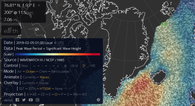
(20-25 foot surf heading for the increasingly fragile sea ice in this February 4 wave model forecast. Note the 30-40 foot waves off Iceland and associated with the same storm system that is predicted to bring above…
View original post 894 more words
